
Ocean Protection Expands in Horn of Africa
February 19, 2015
Four new marine protected areas have been declared in the Republic of Djibouti
Mission Blue partner, KAI Marine, is happy to officially announce the exact positions of the marine protected areas (MPAs) of the Djibouti MPA Program of the United Nations Development Program (UNDP) and the Government of Djibouti. Since 2012, KAI Marine has been assisting UNDP and the Department of Land Management and Environment in the development of the MPA Program’s management plans and communication strategy.
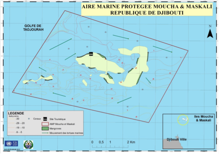
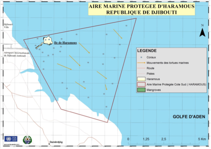
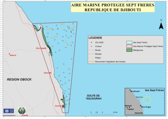
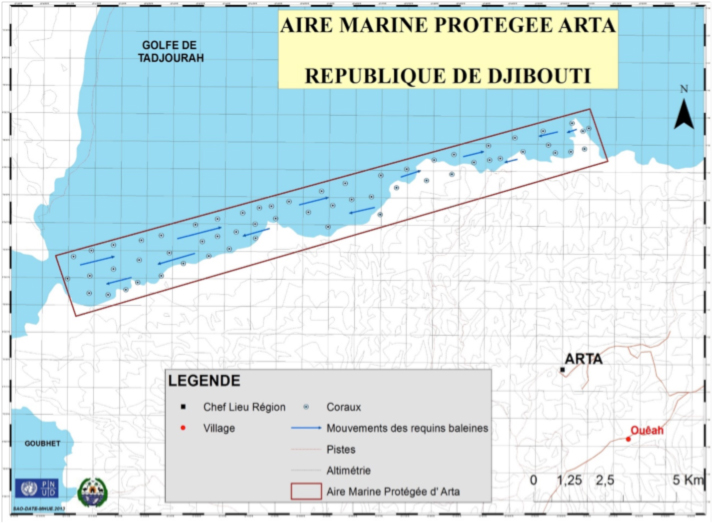
These MPAs, situated at the gates between the Red Sea and the Indian Ocean in a region known as the Horn of Africa, safeguard a hotspot of biodiversity. Pristine coral reefs, mangroves, sea turtle nesting beaches and unique oceanographic features are home to many great pelagic species including the whale shark, whales, dolphins, sea turtles and sea birds. Each of the four new MPAs – called Seven Brothers, Moucha & Maskhali, Arta and Haramous – covers between 35 to 447 square kilometers.
Since 2013, KAI Marine has conducted three missions in Djibouti working with nomadic tribes, fishermen, diving centers and relevant authorities looking at the vulnerabilities and opportunities within these MPAs for sustainable development. By building a relationship with Djibouti stakeholders in the region including local nomadic tribes, KAI Marine is developing a dynamic management plan to ensure that the pristine mangrove forests, coral reefs and beaches are preserved in the face of threats such as climate change and poverty.
One of the lines of action of the KAI team has been to start working on urgent actions with locals such as the establishment of a whale watching code and the installation of anchoring buoys and containers for toxic waste in strategic sites for fishermen and diving centers.
Learn more about the Djibouti MPA Program here: www.programmeampdjibouti.org and more about KAI Marine here: www.kaimarineservices.com
View maps of the new MPAs and their boundaries according to the Presidential Decree of 2014 below:


Thank you for your wonderful work. It is heartening to see this.